Buildings on smart map
Buildings on the smart map![]() A map functionality that uses a geographic information system to visualize devices (for example, cameras and microphones), structures, and topographical elements of a surveillance system in geographically accurate, real-world imagery. Maps that use elements of this functionality are called smart maps. are depicted as polygons with four edges. Once added, you can adjust the dimensions, angles, and size to match the actual shape and position of the building.
A map functionality that uses a geographic information system to visualize devices (for example, cameras and microphones), structures, and topographical elements of a surveillance system in geographically accurate, real-world imagery. Maps that use elements of this functionality are called smart maps. are depicted as polygons with four edges. Once added, you can adjust the dimensions, angles, and size to match the actual shape and position of the building.
If the building is a multistory building, you can start adding levels and add cameras to the individual levels. This allows you to navigate the cameras inside the building, level by level.
To help you illustrate the interior of a level, you can add custom overlays to levels, for example an image illustrating a floor plan. For more information, see Add floor plans to levels (smart map).
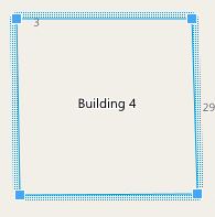
Buildings are automatically given a name, for example Building 4. Milestone recommends that you change the name. This makes it easier for you to distinguish buildings from one another.